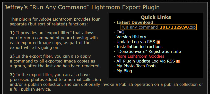
Do you maybe also use Lightroom, so as I do, then I can recommend a lot the very helpful Lightroom plugins from Jeffrey Friedl. Especially regarding GeoSetter there’s a very handy plugin called “Run Any Command“. With this plugin you can launch commands for all selected image files. So it’s also possible to run GeoSetter with it from within Lightroom. GeoSetter will then be started in a special mode, called “Collection Mode”, in which only all selected files will be shown, no matter in which physical folder they are located on your harddisk.
Here is a short instruction:
Step 1
Download and install the plugin in Lightroom. How to do this, I will not describe here now ?
Step 2
Now the plugin has to be configured under “File | Plug-in Extras | jf Run Any Command | Configure…”. As the command you have to put in something like:
"C:\Program Files (x86)\GeoSetter\GeoSetter.exe" /PARAMS="{MANIFEST}" /COLLECTION
Step 3
Now you can select any image files in Lightroom, in a library folder, in a collection, wherever. Very important is, that before executing GeoSetter in the next step, all metadata of all selected image files has to be saved to the image files themselves. You can do this by selecting the option “Metadata| Save Metadata to Files”. If you don’t do this, you will maybe lose the current development settings and other data in step 6 below!
Step 4
Now GeoSetter can be started by selecting “File | Plug-in Extras | jf Run Any Command | Custom Command 1”.
Step 5
In GeoSetter you can edit the image files now as you want, for example assign map locations to them. When finished, you have to save your work, of course.
Step 6
Now back in Lightroom, the way vice versa is important, reading in the just changed metadata from the files on your harddisk. This can be done by selecting “Metadata| Read Metadata from Files”. The selection of images and of course also the data of selected files should not have been changed in the meanwhile!
That’s it ?
I also use these plugins from Jeffrey Friedl very frequently: Export to Flickr, Export to Facebook, Collection Publisher, Folder Publisher und Metadata Wrangler…


I got a problem with Google Map JavaScripts API. This error unable to show MAP in geosetter window.How to solved this error?
Bonjour, GéoSetter m’indique de temps en temps que j’ai dépasser les 2000 photos, et que je doit passer à la version commerciale, pourriez-vous me dire quand on fait un don est ce qu’on reçoit une licence pour débloquer le logiciel définitivement, merci!
Plug-in is very important as it makes our work easy and it is also time effective. However, a new plug-in has been added for the Lightroom user and that is “run any command”. This is best for the Geosetter. so you must use this plug-in once.
I got a problem with Google Map JavaScripts API. This error unable to show MAP in geosetter window.How to solved this error?
This was some helpful information but for different plugins there will be some different commands so try to collect it from the website.
Please, I have the same problem with maps now. After using (and loving) the wonderful feature of this application, I’d very much like to find a solution to the “For development purposes only” message.
I got a problem with Google Map JavaScripts API. This error unable to show MAP in geosetter window.How to solved this error?
The message is: Can not load Google Maps correctly on this page.
Do you own this website?
J’ai un problème avec l’API Google Map JavaScripts. Cette erreur ne parvient pas à afficher MAP dans la fenêtre du géosetter.Comment résoudre cette erreur?
Impossible de charger Google Maps correctement sur cette page.
Possédez-vous ce site?
I would love to get rid of the “development purposes only” from the map… how would I set up the API for my own use? I have set up the Google cloud, and set up the project, but no idea on what API I should set up, nor how to link it within GeoSetter… Any idea on how to do so?
Google Maps is no longer free – that is why you see the “development purposes only” watermark. You have to register a credit card so that you can get billed if your site has requests that exceed the $200 credit they give you monthly for free. If it’s only for your own personal use, it’s unlikely that you’ll exceed the monthly free usage limit.
For more information, see: https://cloud.google.com/maps-platform/pricing/
You may also want to consider alternatives to Google Maps – this link gives an overview of some of them:
https://www.geoawesomeness.com/google-maps-api-alternatives-best-cheap-affordable/
i am running windows 11 on my desktop with edge as my browser. i am unable to load the map and have tried many fixes to no avail. I have run out of ideas but would very much wish to be able to work with this great program again. any ideas?
Geosetter works fine standalone. No issues. Meets my needs. I am unable to make the LrC plugin work. I am running LrC v 11.4. I get “Run Any Command” custom command #1 failed.
The command I entered was C:\Program Files (x86)\Apps\GeoSetter\GeoSetter.exe” /PARAMS=”{MANIFEST}” /COLLECTION
GeoSetter is installed in the C:\Program Files (x86)\Apps\GeoSetter\.
Hope you give me some guidance. Thanks in advance.